Nutrient pollution, largely driven by agricultural runoff, remains one of the most significant threats to water quality in the Western Lake Erie Basin. When nutrients, such as phosphorus and nitrogen, wash off the land and into nearby waterways, they fuel harmful algal blooms that threaten drinking water, harm public health, degrade aquatic ecosystems, and disrupt local economies.
Despite ongoing conservation efforts, progress has been limited by a critical gap: we have not had enough detailed, upstream data to understand exactly where within watersheds runoff is occurring, when it is happening, or how nutrients are moving through the landscape. Without that information, it is difficult to target solutions effectively or measure whether investments are working.
A new approach: monitoring where it matters
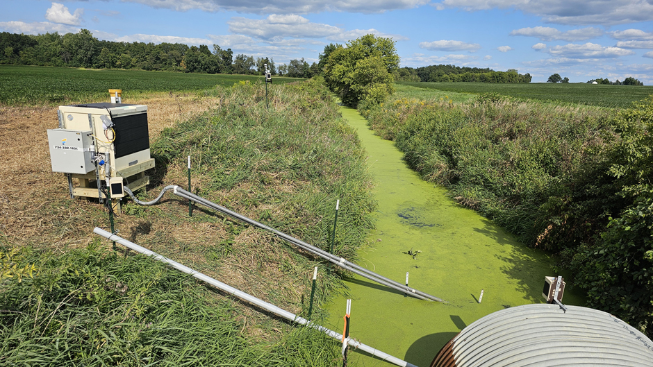
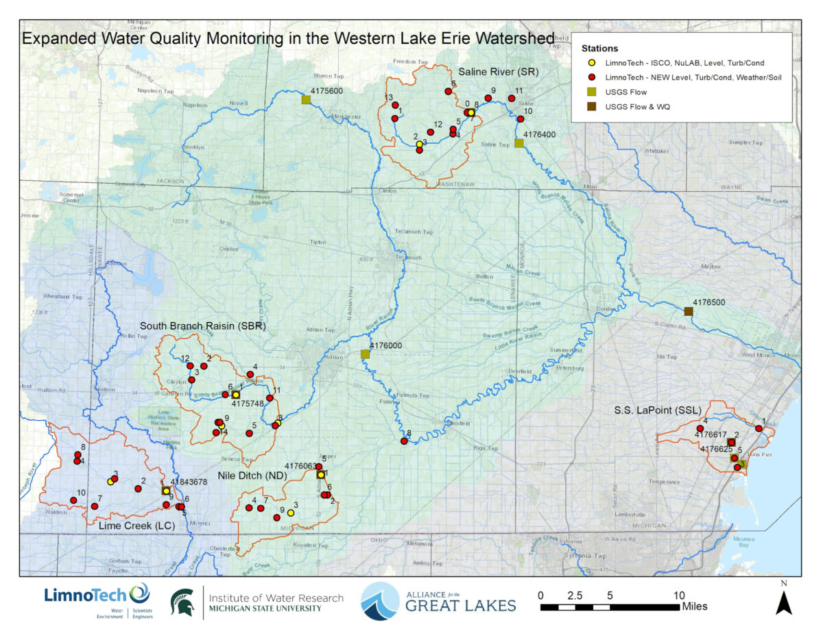
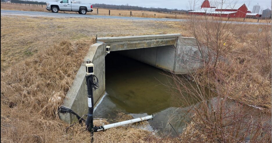
To address this challenge, the Alliance for the Great Lakes, in partnership with LimnoTech and Michigan State University’s Institute for Water Research, developed a high-density water quality monitoring network across five priority sub-watersheds in Michigan. Supported by the Michigan Department of Agriculture and Rural Development and Erb Family Foundation, the network includes 50 monitoring sites and 200+ sensors that continuously track rainfall, soil conditions, water levels, turbidity, and nutrients.
What makes this network unique is its ability to capture water quality data with new technology at a much finer scale than traditional monitoring. Rather than measuring conditions only after pollution reaches Lake Erie or at further downstream reaches, this system tracks how water and nutrients move through headwaters, agricultural ditches, and streams in near real time. It also captures conditions during rain events – when most nutrient runoff occurs – and includes subsurface monitoring to better understand how tile drainage contributes to nutrient transport. Together, these capabilities provide a more complete picture of how pollution moves across the landscape.
What we’re learning (so far)
After the first year of monitoring (August 2024–July 2025), early findings are already revealing important patterns, while also highlighting the need for continued data collection to confirm long-term trends.
Weather impacts
- Everyday rainfall – not just extreme storms – plays a significant role in moving water, sediment, and nutrients through these watersheds.
- A transition from fall drought to a wet spring amplified runoff and water quality impacts, demonstrating how seasonal conditions can shape outcomes across the watershed.
Nitrate and phosphorus levels
- Phosphorus levels are elevated and consistent with what is typically seen in agricultural systems.
- Nitrate concentration in some locations exceeds the federal standard for safe drinking water (10 mg/L MCL).
- More data is needed to fully understand how nutrient levels vary across sites over time.
Role of natural features
- Watersheds with more natural features, such as wetlands and forested areas, tend to slow water movement and reduce sediment transport.
- Intensively agricultural and tile-drained areas respond more quickly to rainfall and generate higher sediment loads.
Why this matters for policy and practice
This monitoring effort is designed to do more than generate data; it is intended to support better decision-making and more effective water quality policies. By identifying where pollution originates and how it moves, the network can help direct conservation investments to the areas where they will have the greatest impact.
Just as importantly, this data could provide value to farmers by offering clearer insight into how water moves across their fields and how management decisions influence runoff. With more localized, real-time information, farmers can better target practices, improve efficiency, and make informed decisions that keep nutrients on the field rather than losing them to waterways.
The data could also provide a way to evaluate which conservation practices are working. Over time, the network will allow stakeholders to measure the effectiveness of strategies such as cover crops, wetland restoration, and drainage management, and adjust approaches based on real-world outcomes. In addition, this level of transparency improves accountability by allowing agencies, policymakers, and the public to track progress toward water quality goals.
Ultimately, this information supports more strategic, science-based policies and on-the-ground practices that align funding, conservation efforts, and regulatory approaches with measurable improvements in water quality.
Looking ahead: from data to action
This is the first year of a multi-year effort, and additional data are needed to fully understand long-term trends, particularly nutrient loads. Early findings are clear: how land is managed has a direct impact on how water and nutrients move through the system. As more data are collected, this network will track changes over time and link conservation actions to measurable outcomes. By improving our understanding of where pollution comes from and how it moves, this work helps direct solutions, strengthen policy, and drive meaningful progress toward cleaner water in the Western Lake Erie Basin.
Explore the data
The monitoring network is publicly accessible through an online dashboard that provides near real-time data across all monitoring locations. Users can explore trends in rainfall, water levels, turbidity, and nutrients, and begin to see how conditions change across watersheds and over time.
Visit the Dashboard: https://greatlakes.org/wlebmonitoring/